.avif)
Drone-Based Subsurface Mapping for Safe, Rapid Landmine Survey & Geo-Location
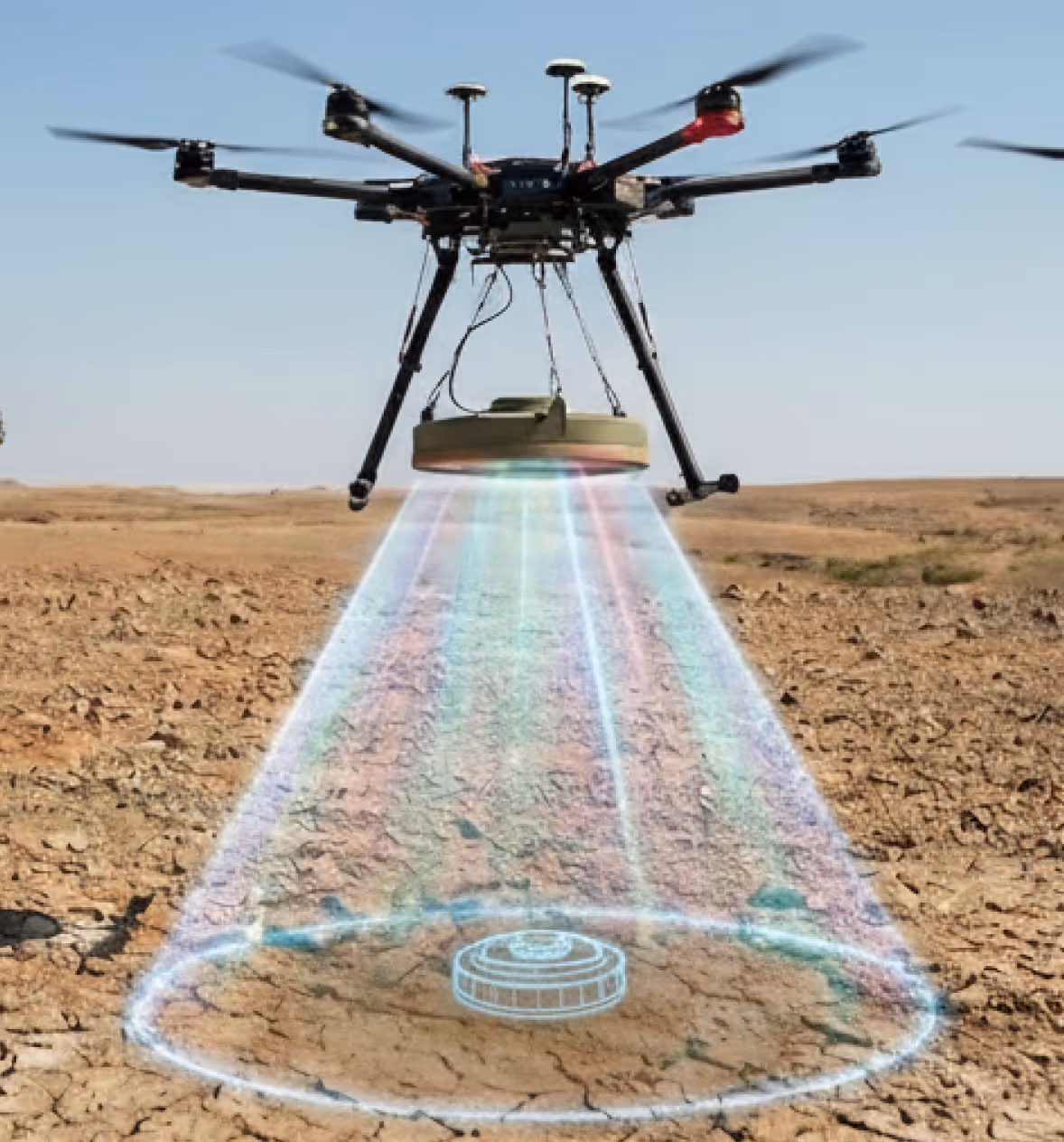
This system develops an airborne, drone-based platform for rapid detection and geo-location of shallow-buried landmines using software-defined Ground Penetrating Radar (SDR-GPR). By shifting hazardous surveys entirely to unmanned platforms, it eliminates human entry into contaminated zones while maintaining high detection accuracy. A mapping drone integrates wideband SDR-GPR and optical payloads to identify subsurface anomalies and produce GIS-ready outputs supporting informed clearance planning with measurably improved safety and operational efficiency.
Key Capabilities
Detection & subsurface sensing
Airborne GPR mapping
Drone-mounted SDR-based GPR enables non-contact detection of shallow-buried objects from the air significantly reducing operator risk during initial survey operations without sacrificing detection capability.
- Non-contact sensing no ground personnel required in hazard zones
- Covers large survey areas at a fraction of the time of ground-based methods
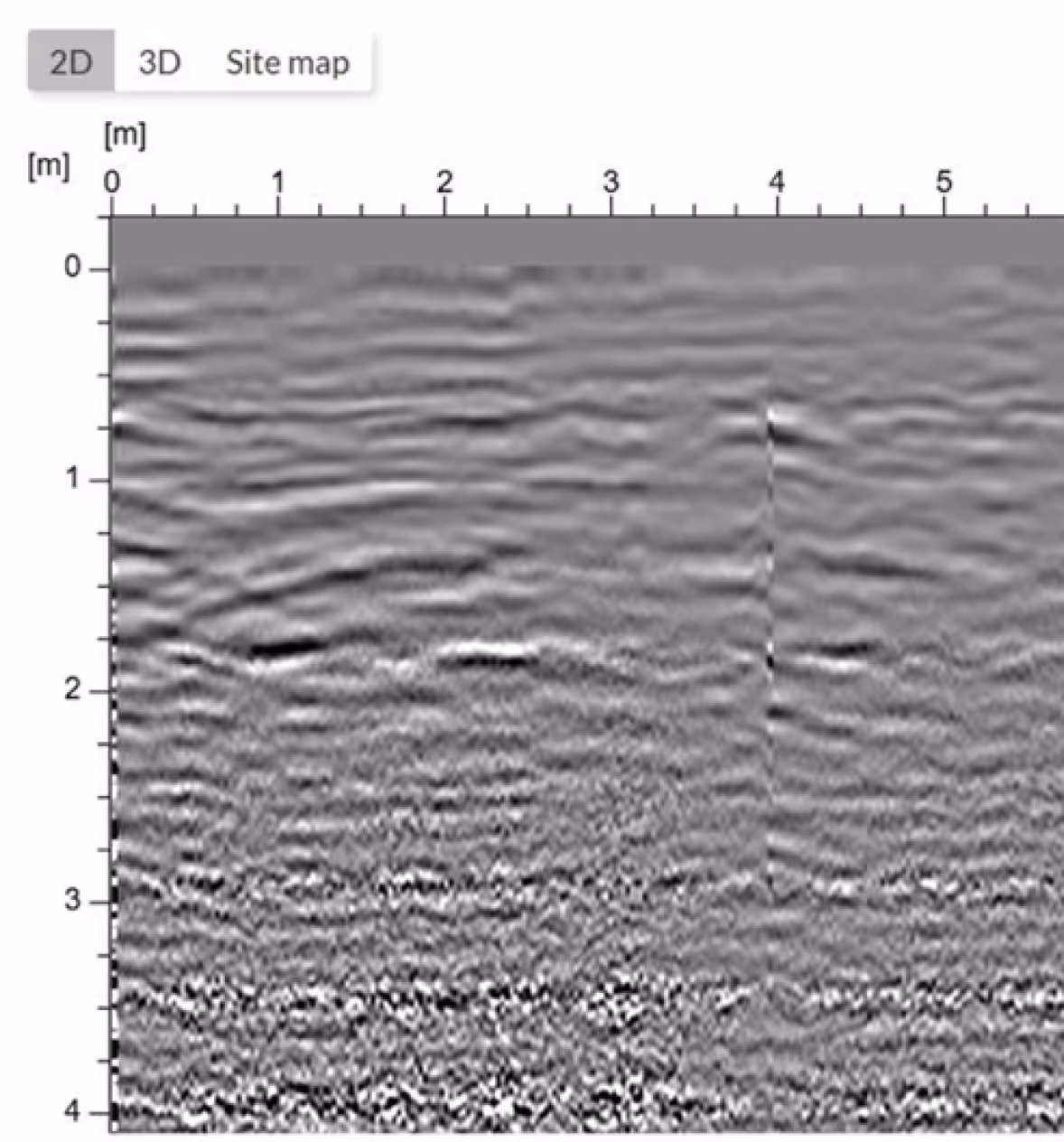
High-resolution subsurface sensing
Wideband radar architecture provides fine depth resolution suitable for detecting small, low-metal-content objects with optimised frequencies that balance penetration depth against spatial clarity.
- Detects low-metal and plastic-cased landmine variants
- Frequency tuning adapts to soil type and moisture conditions
Positioning & onboard processing
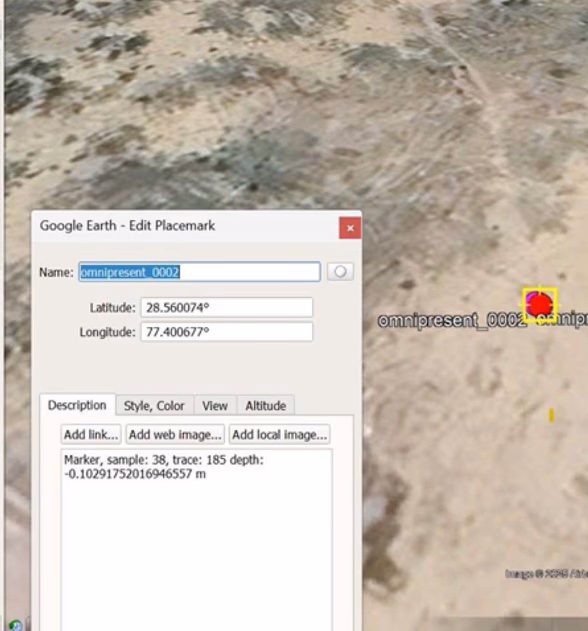
RTK GNSS and inertial sensor fusion deliver centimetre-level positioning accuracy ensuring all subsurface detections are precisely mapped for repeatable survey, follow-up operations, and clearance planning.
- Centimetre-level accuracy for every flagged detection
- Repeatable survey coordinates enable reliable follow-on ground action
Edge-based intelligence
Onboard processing performs preliminary signal conditioning and anomaly flagging during flight enabling faster mission turnarounds, reduced data transfer loads, and efficient post-flight analysis workflows.
- In-flight anomaly flagging reduces post-processing time on the ground
- Efficient data handling supports rapid re-tasking between survey sorties
AI classification & operational output
AI-assisted classification
Machine learning models analyse GPR signatures and optical imagery jointly to categorise detections with confidence scores reducing false positives and significantly lowering operator analytical workload.
- Confidence-scored outputs support prioritised clearance planning
- Fused GPR and imagery analysis improves classification accuracy
GIS-ready outputs
Standardised geospatial layers compatible with existing GIS platforms supporting clearance planning, operational documentation, regulatory reporting, and structured handover to follow-on teams.
- Compatible with standard GIS formats for immediate operational use
- Audit-ready documentation for compliance and clearance reporting
Impact
Safe, scalable land assessment without human entry into hazard zones. Large areas in operational and post-conflict regions remain unusable due to buried landmines while existing ground-based detection methods are slow, high-risk, and labour-intensive. This system introduces an airborne detection approach that delivers safe, rapid, and accurate subsurface mapping without any human presence in contaminated zones. By providing actionable location intelligence, it enables scalable land assessment, informed clearance planning, and safer management of contaminated areas at a pace and scale that ground teams cannot match.


.avif)

.svg)
.png)
Explore other projects