

Satellites that %%see, think, and deliver%% autonomously

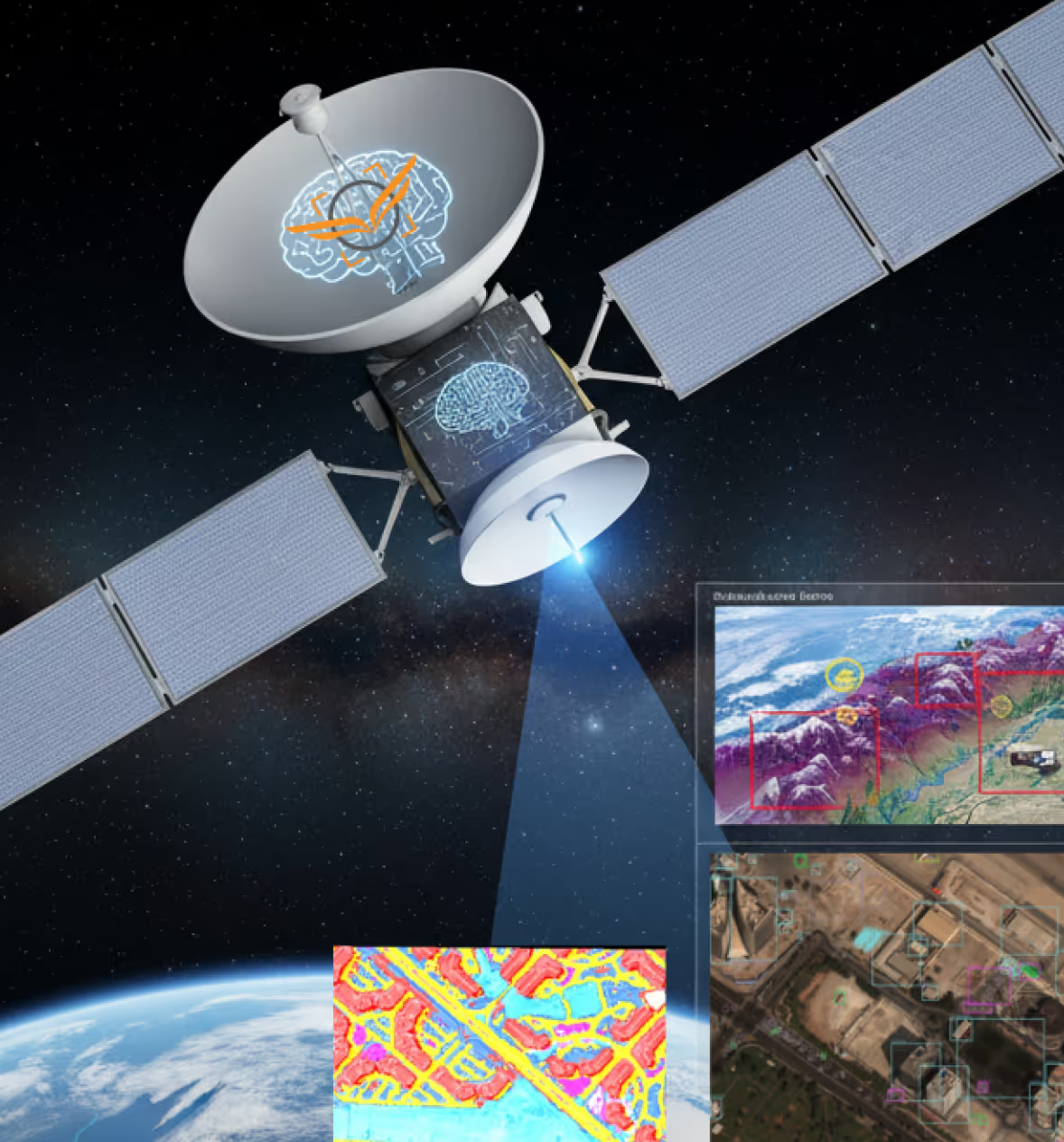

Intelligent onboard geospatial analytics for automated satellite imagery interpretation.
India's first space-based real-time AI processing platform brings onboard geospatial intelligence directly to the satellite payload detecting objects, assessing change, and delivering actionable insights the moment data is captured, eliminating the latency and dependency of ground-based post-processing entirely. Unlike conventional Earth observation systems that ship raw data down for analysis, our platform processes at the source making it faster, leaner, and mission-ready for time-critical Operations, disasters, and monitoring applications, all built on a modular, scalable architecture designed to evolve with every future mission.
Key Capabilities
Onboard AI processing
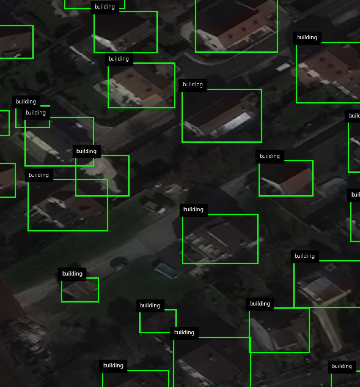
Real-time onboard segmentation
- Satellite imagery is segmented and analysed directly at the payload delivering actionable intelligence at the point of capture, with no ground relay required.
Object detection & change assessment
- Detects objects and assesses temporal change across image sequences in-orbit enabling dynamic situational awareness without post-processing latency.
Threat detection & classification
- AI-driven threat identification, classification, and segregation performed onboard maintaining full processing capability in contested or communications-degraded environments.
Multi-sensor ISR architecture
All-terrain, all-climate operation
- Consistent performance across mountains, deserts, coastlines, and urban zones operational under rain, cloud cover, dust, and extreme temperatures without degradation.
Recognition & targeting correlation
- A dedicated correlation system for precision identification of threats and assets supporting targeting workflows with high-confidence object recognition at orbital resolution.
Sovereign data pipeline & analytical intelligence
Fully in-house data pipeline
- End-to-end proprietary workflow — from data intake and intermediate processing to final output generation — with no dependency on third-party geospatial platforms or external processing tools.
In-house annotation framework
- Domain-specific labelling accuracy ensured through a proprietary annotation framework trained on operationally relevant datasets with iterative refinement at each validated development phase.
Land use prediction
- Deep spectral and spatial analysis across multi-band imagery enables prediction of land use patterns supporting environmental monitoring, urban planning, and resource management.
AI-powered change detection
- Temporal imagery sequences analysed onboard to detect surface, structural, and environmental change delivering continuous monitoring without manual image comparison.
Ground station & operational integration
Secure dedicated ground station
- Purpose-built, mission-specific ground infrastructure with encrypted data relay between satellite payload and authorised operators designed for integration with existing operational systems.
Modular scalable architecture
- Independent modules allow parallel development, easier subsystem integration, and future enhancement without disrupting existing functionality scalable from current LEO deployment to multi-orbit, multi-platform configurations.
Impact
The project addresses the growing challenge of delivering timely insights from large volumes of satellite imagery. By moving beyond raw data downlinking and ground-heavy processing, it enables intelligent, selective analytics at the source—prioritizing relevant insights through automated object detection and change awareness. This reduces latency and data load while supporting faster decisions and improved situational awareness across Earth observation use cases.


.avif)


.svg)
.png)
Explore other projects