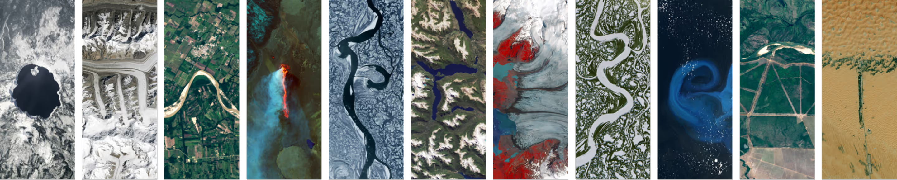
India’s most accurate %%DEM and 3D Mapping%% with High-Resolution SAR


Flagship initiative developed as part of the prestigious ADITI scheme under iDEX Challenges.
The project generates a high-resolution, SAR-based Digital Elevation Model (DEM) for large-scale land surveys, disaster management, elevation mapping, and more. Using advanced SAR technology and precision geospatial workflows, it delivers highly accurate, reliable, all-weather elevation data for critical national applications.
Key Highlights
Indigenous High-Resolution SAR Sensor
Development of a state-of-the-art Indian Indigenous SAR sensor capable of capturing extremely fine-resolution data, including over complex and rugged hilly terrains.
Next-Generation DEM Generation
Capability to produce precise DEMs under cloud cover, night conditions, and challenging topographies, where optical systems fail.
Advanced Interferometric Techniques
Leveraging InSAR and precise baseline configuration to extract accurate surface elevation information
Scalable for Large-Region Mapping
Designed to process massive geographies, making it ideal for national-level mapping, defense applications, and disaster management
Impact
OmniSAR3D enables high-precision, all-weather elevation mapping critical for national planning, defense operations, and disaster management. By delivering MSL-accurate DEMs across large and complex terrains, the project advances India’s indigenous geospatial capabilities and represents one of the country’s most scientifically rigorous SAR-based elevation mapping initiatives.


.avif)

.svg)
.png)
Explore other projects